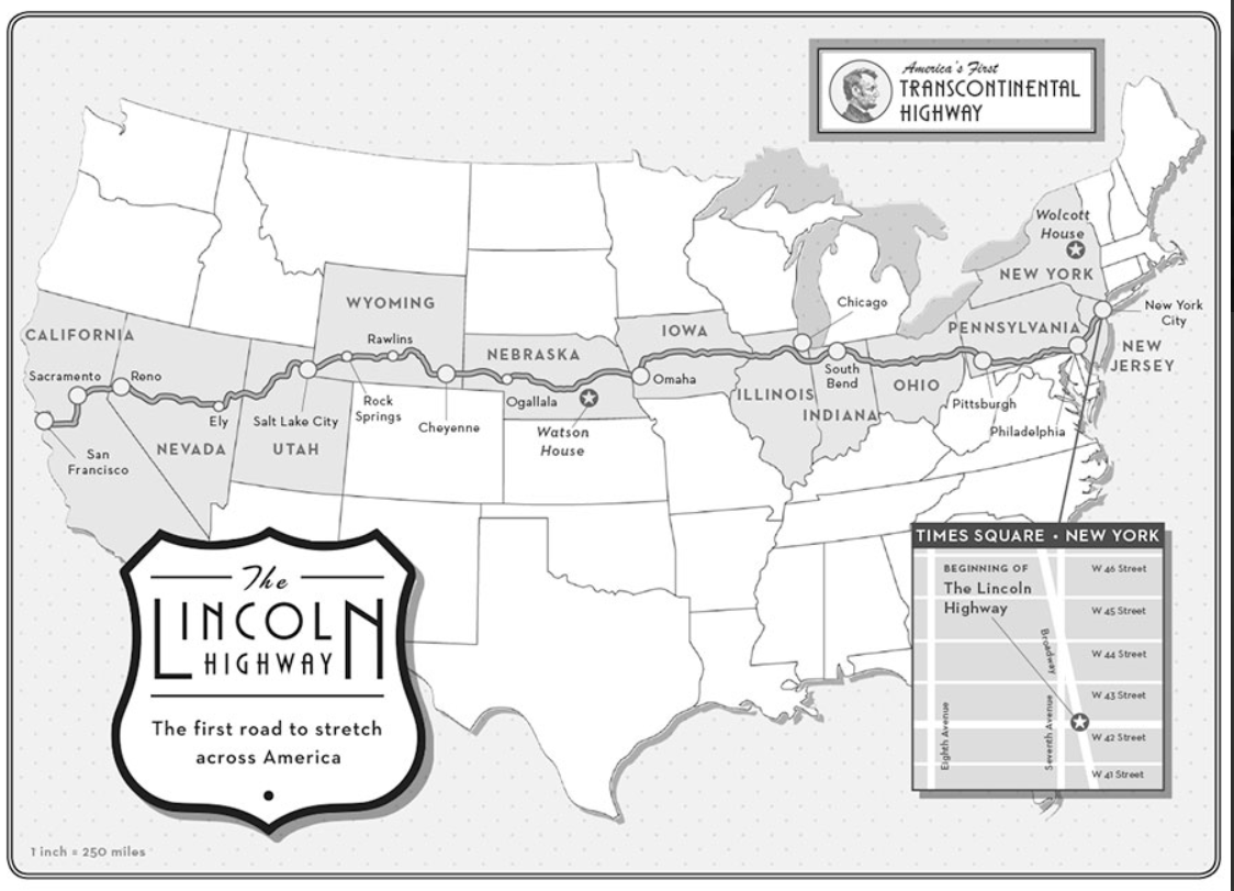
If Amor Towles’s new novel, “Lincoln Highway,” has fired up your wanderlust and you want to learn more about the old road, check out this link to the author’s web page. Full of fantastic photographs and history of the highway. Check out this map which is featured at the beginning of the book.
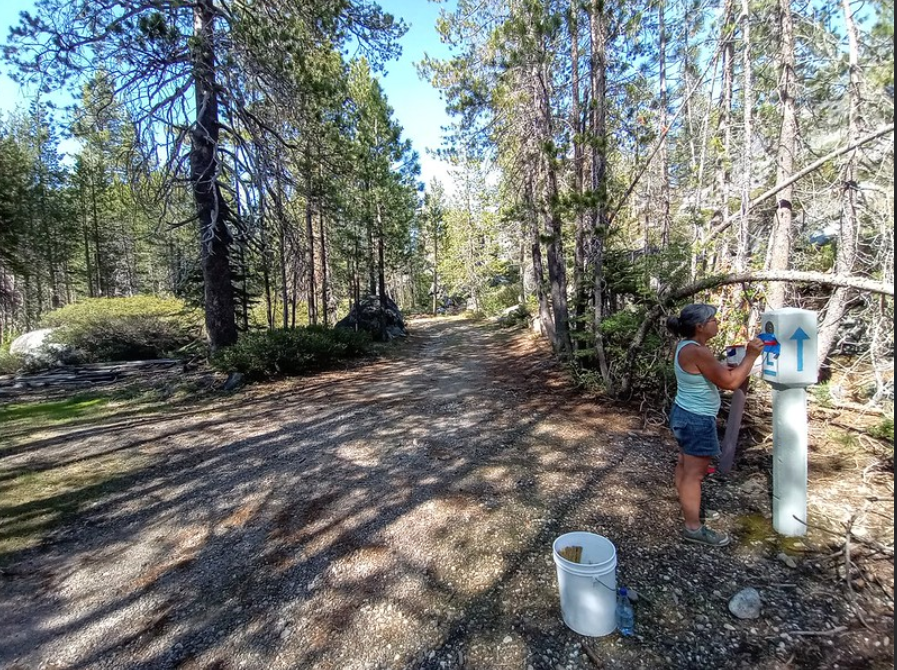
The photo above shows Monica Pitsenberger, California Chapter, touching up a replica marker at Big Bend in the High Sierra of California. The Lincoln Highway Association (LHA) comprises members who are passionate about road history and seeing it preserved. When you join the Association, you will work with your state chapter to encourage markers and signs to be placed along your section of the highway.
Monica is painting an LH “L” on a bridge at Big Bend, CA.
Here in California, as with the other Lincoln Highway states, members petition local authorities to help recognize the highway. Often monuments and signs need repair or repainting, and it’s the members of the various chapters that get the work done. If you like to see history saved and even brought back to life, then the LHA is just the organization for you. You can join online here.
Those planning a vacation trip along the nation’s first highway can now identify the locations of RV campgrounds using the homepage association’s website: www.lincolnhighwayassoc.org. Clicking on the blue tent symbol at any point along the national route displays the name and address of the campground in a pop-up box.
Established in 1913, the Lincoln Highway still exists in its many forms, clearly marked and offering a taste of motor travel as it existed before the Interstates.
Experience it a piece at a time in one or more of the 13 states through which it passes, between Times Square and San Francisco.
The online integrated map can help plan a trip and guide travelers along the way. Thousands travel over the route every year. Get off the four-lane whenever you wish and pick a more relaxed way to motor through the towns and villages that carry that unique taste of Americana.
There are hundreds of stop-over choices along the way including, historical attractions, sites of interest, and camping locations liberally situated. It’s the road that challenged the way Americans traveled, and it’s waiting for new explorers today: driveable, prosperous, and ready to host a most pleasant, informative, and memorable adventure.
For more information contact:
John Jackson, Marketing Section Lincoln Highway Association PO Box 1326 Delaware, Ohio 43105 Website: lincolnhighwayassoc.org e-mail: hq@lincolnhighwayassoc.org
Summer is almost upon us, and you know what that means Road Trip! This video is the work of a father and son who took three days to follow Highway 50 across Nevada. The route of Highway 50 follows in many places the older Lincoln Highway. In the video, we will see several Lincoln Highway posts and other attractions along the way. Enjoy!
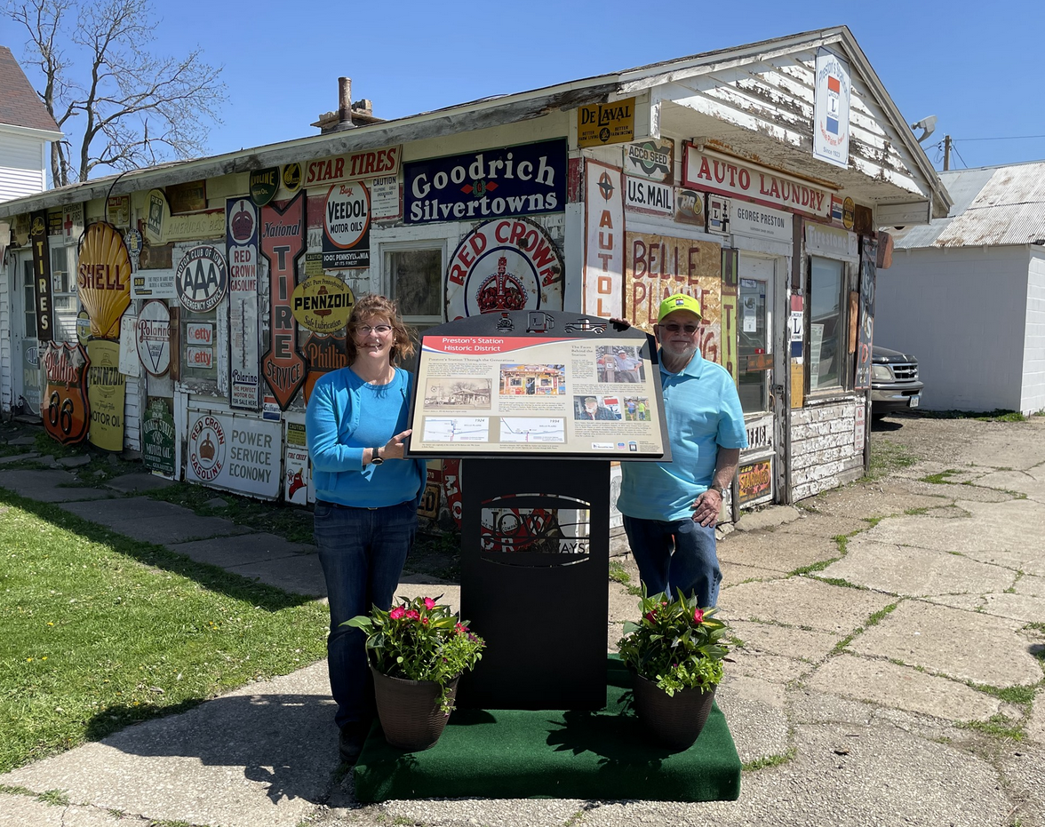
On Saturday, May 1st, Preston’s Station Historic District unveiled an interpretive panel sharing the Prestons’ history through four generations. 10 interpretive panels have been installed across Iowa on the Lincoln Highway. Preston’s was the first project to unveil an interpretive panel. According to Prestons’, their town of “Belle Plaine is the greatest little town on the Lincoln Highway in the state of Iowa.”
This semester three students from Dr. Fisanick’s @CalUofPA Honors English program created a 4.5-minute presentation about the 1919 Motor Transport Corps Convoy, which included future President Dwight Eisenhower.
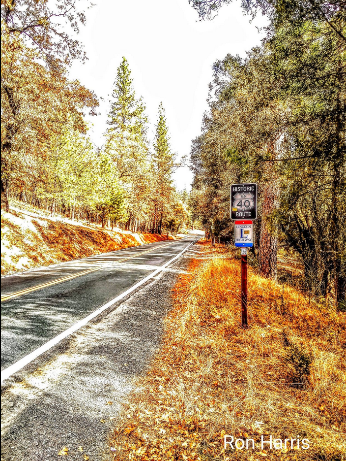
Ron Harris Photography will sometimes include photos of the Lincoln Highway. Here is one of “The Highway” near Applegate, California. In 1927 the Lincoln Highway became Highway 40 in this part of California. This stretch of road between Auburn and Baxter is a premiere “back road experience” road trip. You can follow our signs or our interactive map online here.
This post is the first of what we hope will be one of many that show how people today are helping us to remember the Lincoln Highway. Suppose you’re an active member who does this kind of work in your neck of the woods; let us know. Send some photos and a story, and we might publish it here. Leave a comment at the end of the post so we can connect.
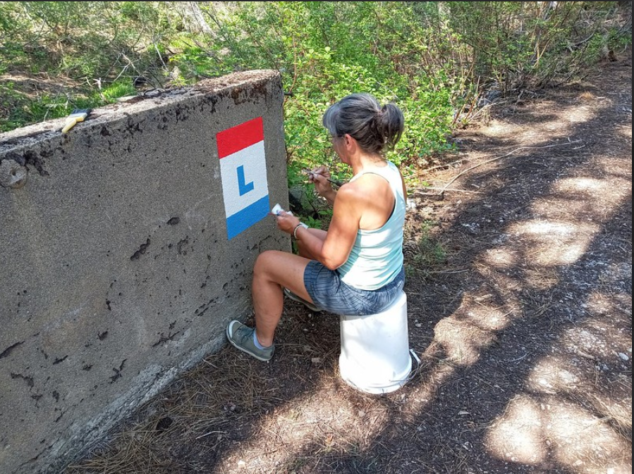
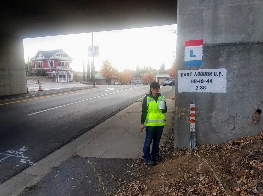
The following is a project that my wife Monica and I completed in our area in California.
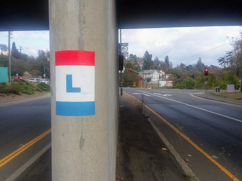
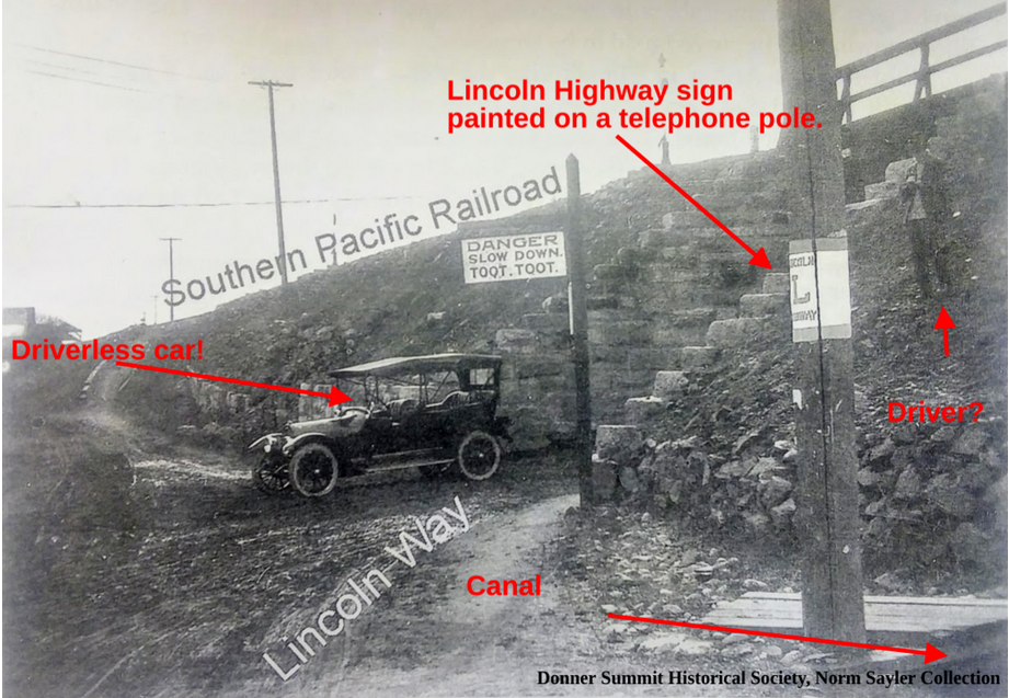
The bridge is newer, but there has been a railroad over-crossing at El Dorado Road and Highway 49/193 in Auburn since 1905! Monica and I spent part of Tuesday painting the Lincoln Highway “L” on both ends of the span. The California Chapter of The Lincoln Highway Association (CLHA) uses signs and these stencils to mark the path of the old road, just as the sign painting crews did it from 1914 to 1928.
The CLHA has recently painted other railroads over-crossings, including the 1910 Newcastle tunnel on Old State Highway, two crossings in Applegate, one at Heather Glen, Weimar, Secret Town, and the South Yuba Bridge at Cisco Grove, and finally one at Donner Summit. The Stenciled “L’s” goes along with our Historic Lincoln Highway signs you will notice along the old road. Be sure to check them out when you drive by.
The photo above is looking east. We painted two logos on this side of the bridge.
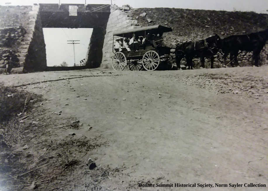
The picture above shows the same underpass but looking north from the west side.
“DANGER SLOW DOWN. TOOT. TOOT.â€
How can you find and follow the Lincoln Highway? Besides the signs and stencils, the Lincoln Highway Association publishes a Google interactive map showing the route across the country. Just keep zooming in until you are at a level that’s easy to follow. You can find the map here.
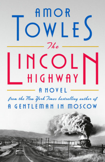
From the author of a Gentleman in Moscow comes a new book with an intriguing title, “The Lincoln Highway.” The publisher, Penguin Books has this to say,
“The bestselling author of A Gentleman in Moscow and Rules of Civility and master of absorbing, sophisticated fiction returns with a stylish and propulsive novel set in 1950s America
In June 1954, eighteen-year-old Emmett Watson is driven home to Nebraska by the warden of the juvenile work farm where he has just served fifteen months for involuntary manslaughter. His mother long gone, his father recently deceased, and the family farm foreclosed upon by the bank, Emmett’s intention is to pick up his eight-year-old brother, Billy, and head to California where they can start their lives anew. But when the warden drives away, Emmett discovers that two friends from the work farm have hidden themselves in the trunk of the warden’s car. Together, they have hatched an altogether different plan for Emmett’s future, one that will take them all on a fateful journey in the opposite direction—to the City of New York.
Spanning just ten days and told from multiple points of view, Towles’ third novel will satisfy fans of his multi-layered literary styling while providing them an array of new and richly imagined settings, characters, and themes.”
While the book doesn’t actually cover the era our Lincoln Highway does, 1913-1927, the title shows the highway’s enduring appeal, adventure, and the freedom of the open road. The book comes out in October. See more here.
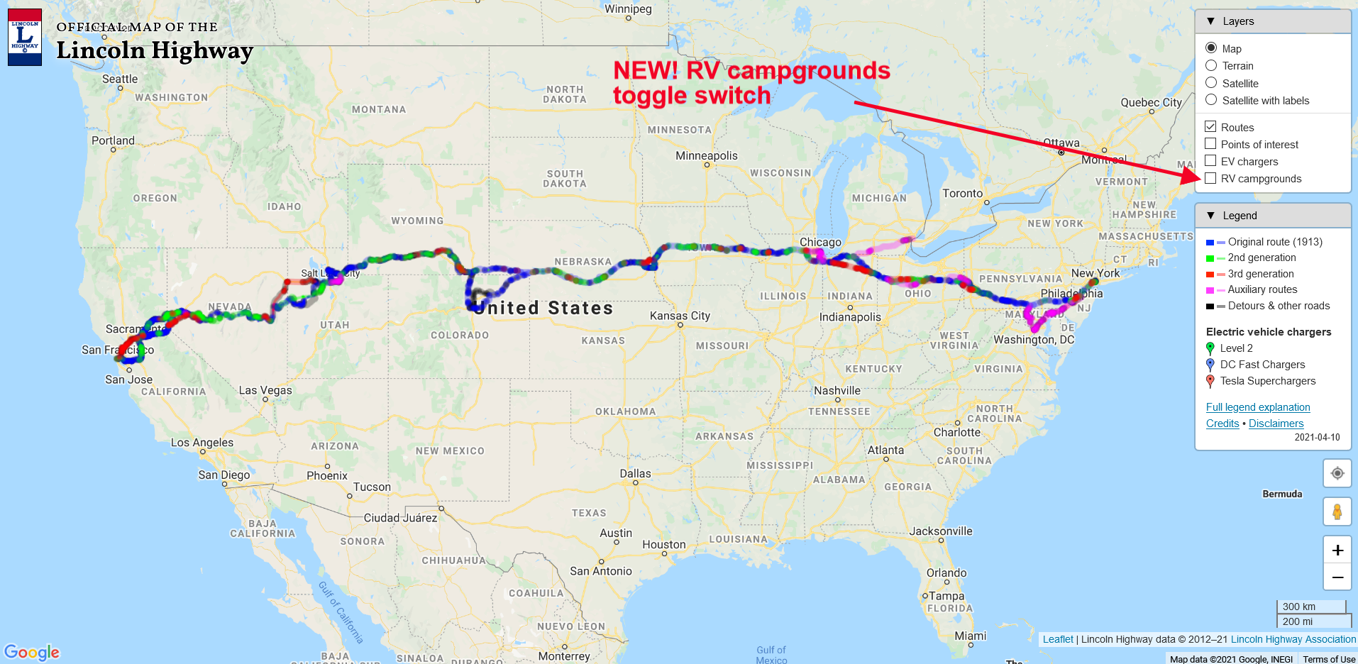
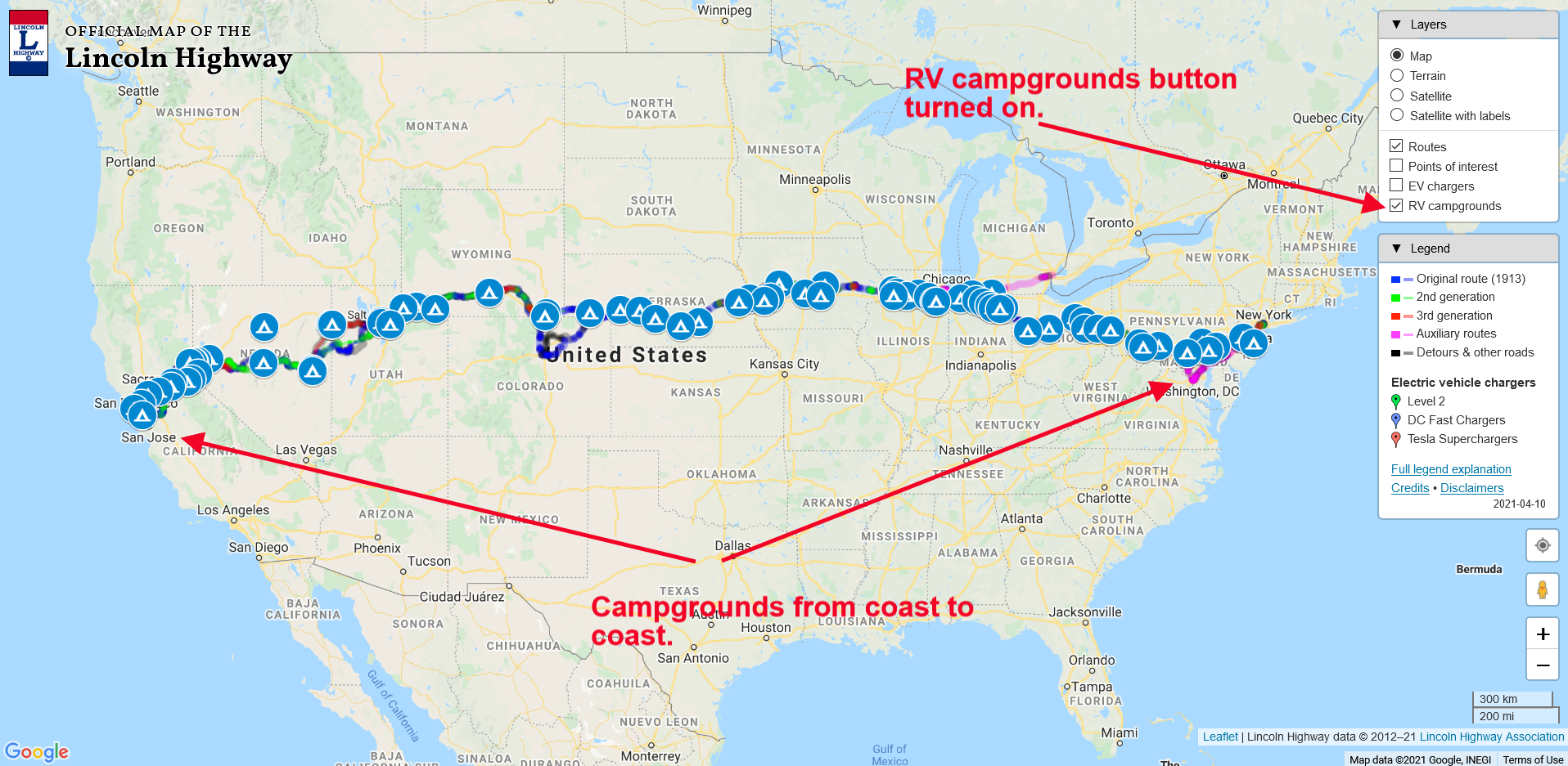
Soon it will be time to hit the road for some camping adventures. Now you can find out where the best campgrounds are using our Lincoln Highway interactive map.
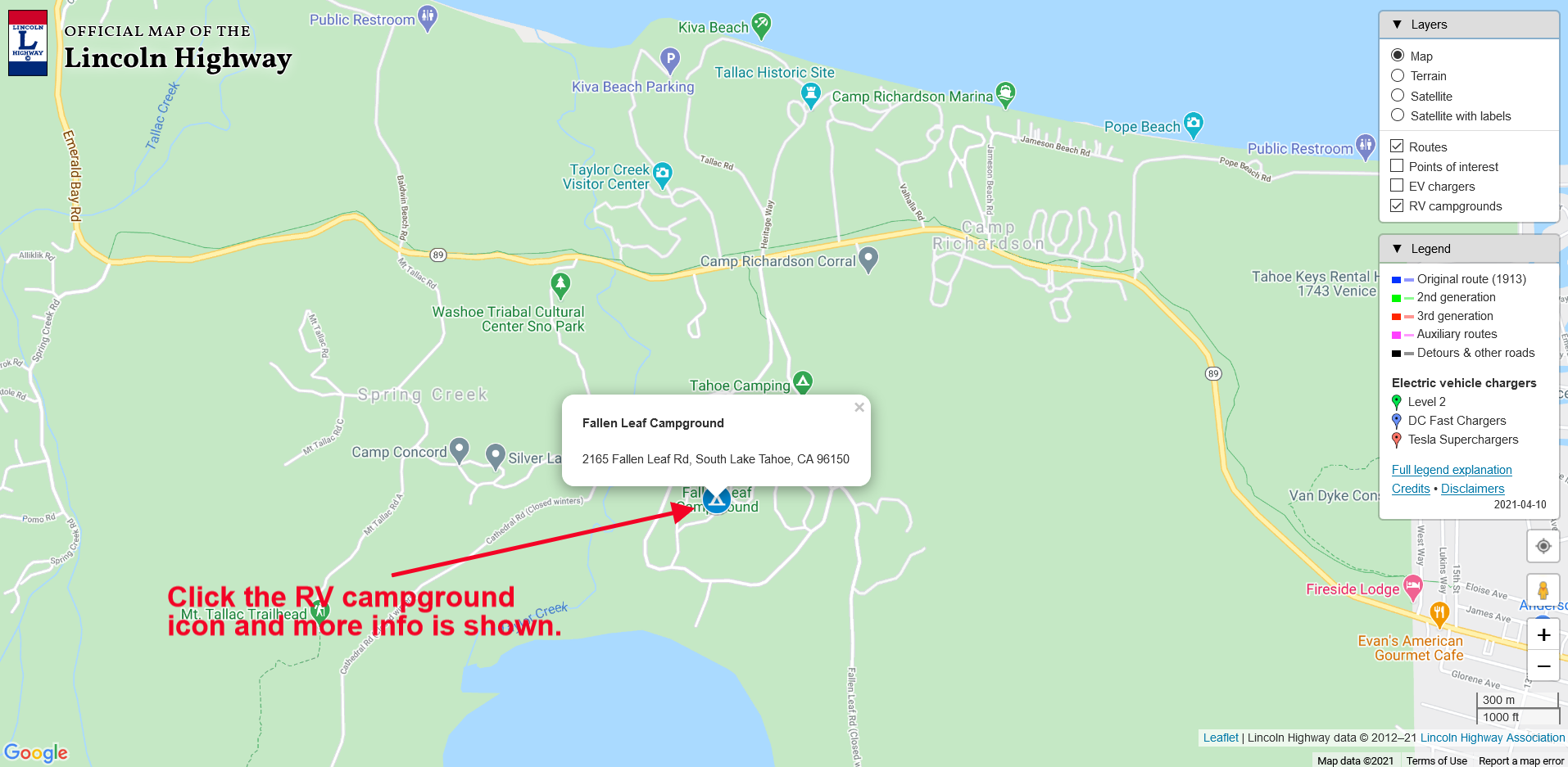
You can see the new “RV campgrounds” button that you “click” to bring up the campground icons in the map below.
Once the button is clicked, the RV campground icons will show across the country. This is a work in progress, so as we discover more quality campsites, we can add them to the map. Check out the map below to see what clicking the button does.
The default view for the map shows the entire country. To see more detail, zoom in using the “+” button at the lower right. You can continue to zoom in until the street names become visible, as seen in the screengrab below. Here we see the Fallen Leaf Campground just south of Lake Tahoe, California.
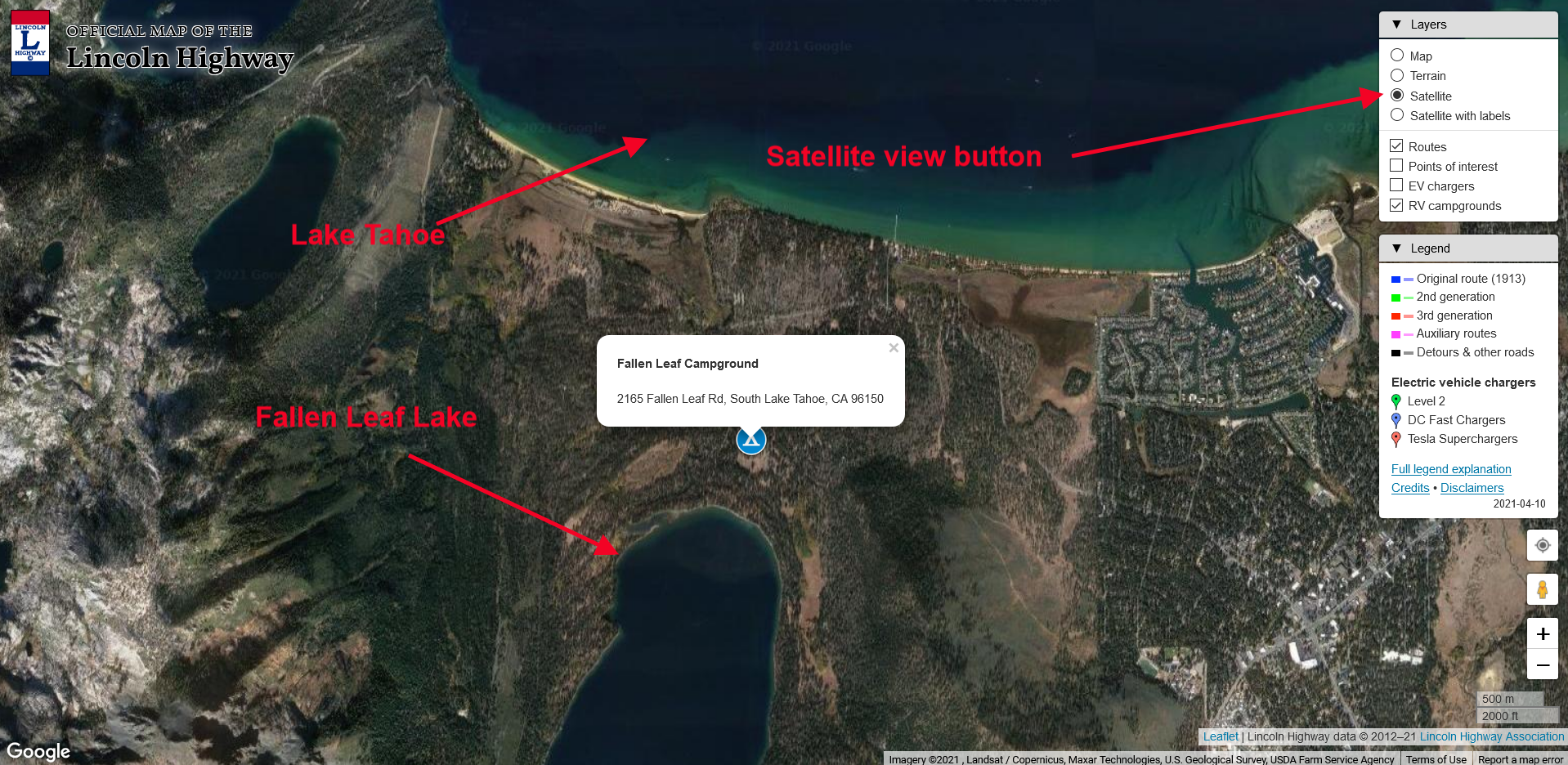
Don’t forget that you can also toggle the map to a satellite view by clicking the “satellite” button, shown with the map below and the red arrow. Pretty cool!
Now that our cartographer Paul Gilger has added the RV Campgrounds to our expanding list of features, we will be presenting a “how to use our map” tutorial shortly. We’ll let you know here when it’s available for viewing.
Start planning that Lincoln Highway camping adventure today!