Rockslide at Echo Summit, and our Lincoln Highway Map

Photo of the rock slide from Cal Trans.

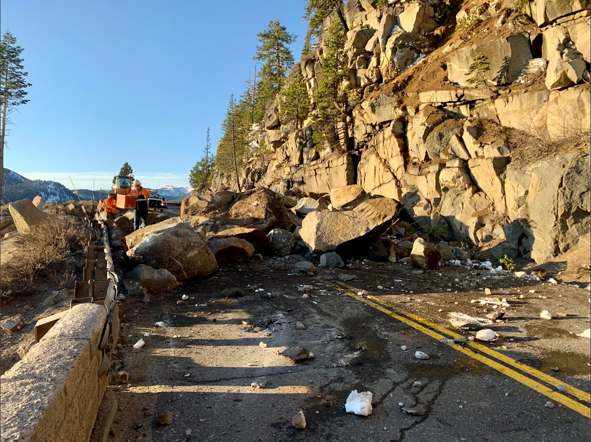
There was a rock slide at Echo Summit, along the southern or Pioneer Route of the Lincoln Highway. The rock slide occurred on a section of Highway 50 built after the route over the summit was re-routed from Johnson’s Pass in the 1930s.

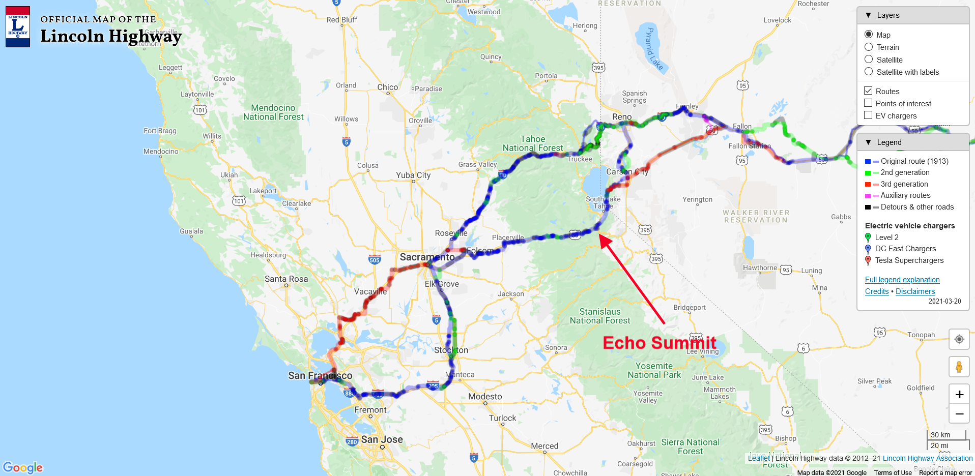
Using our interactive Lincoln Highway map, we have zoomed in to see California and the state’s two routes below. The Northern or Scenic Route crossed The Sierra at Donner Pass, while the southern or Pioneer Route crosses the Sierra at Echo Summit. The red arrow points out the site of the rock slide.

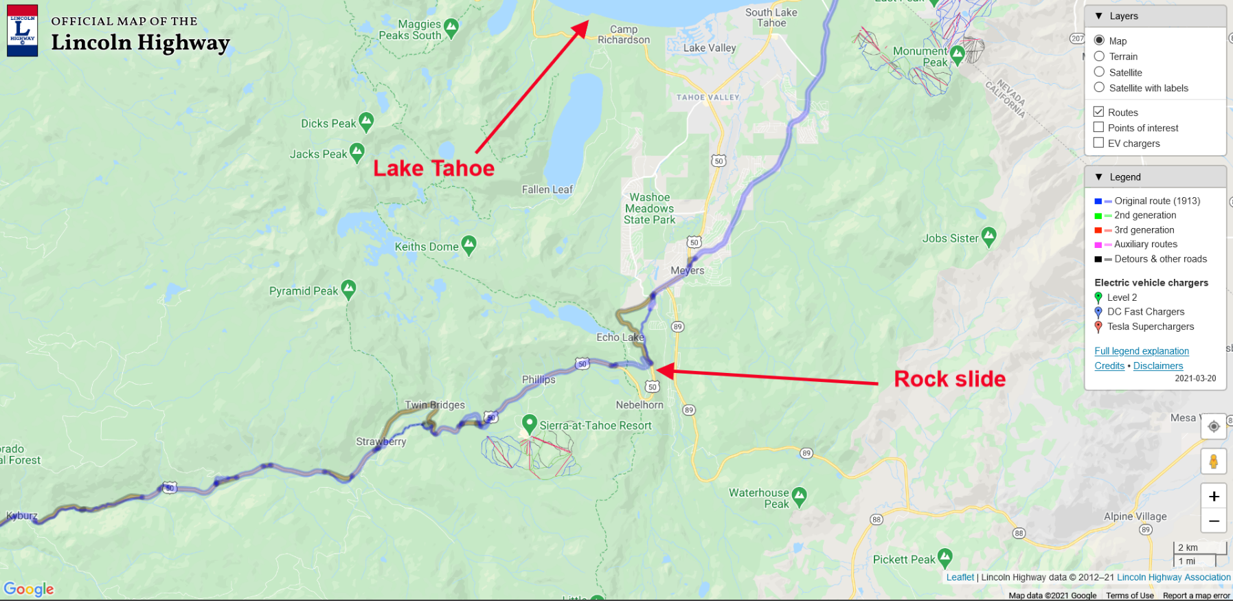
Let’s zoom in on the map for a closer look. We can see the blue line, which represents the original 1913 Lincoln Highway. Lake Tahoe is to the north, while the rock slide at Echo Summit is shown with the second arrow.

Now let’s zoom in even further and using the “Layers” drop-down at the upper right and toggle to the satellite view. Below is the map with an even closer view and toggled to the satellite feature. Here we can see the historic Johnson’s Pass on the old Lincoln Highway. The current route over Echo Summit has Highway 50 making a loop around Johnson’s Pass, thus avoiding some very steep climbs and tight turns.

Johnson’s Pass on the Lincoln Highway is still drivable once the snow melts. During the winter, Johnson’s Pass Road is snowbound. Now and then, when something happens on the current Highway 50, people are still re-routed over the old pass.

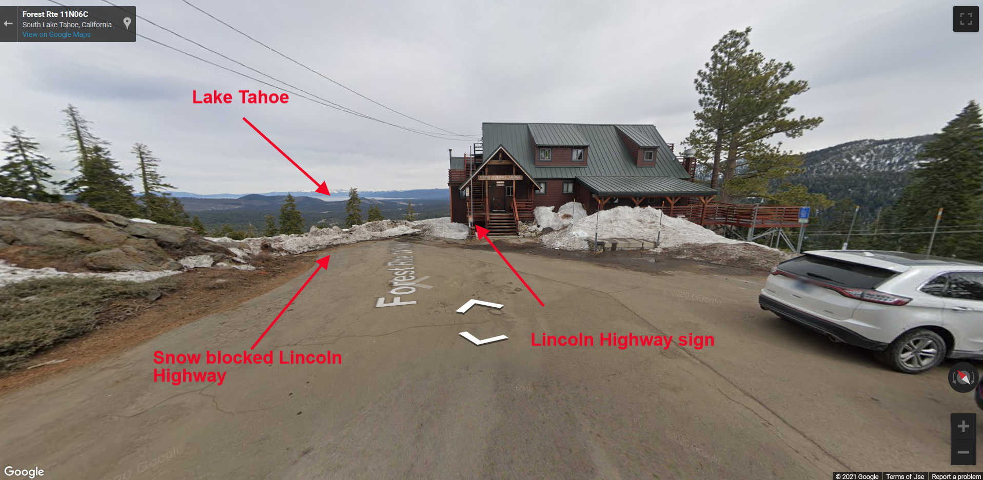
In the photograph below, we see the summit at Johnson’s Pass. That’s the Alpine Club building straight ahead, with a Lincoln Highway sign attached to the building. You can also see the snow blocked route down towards Lake Tahoe. To enable a street view from our map, drag the “street view icon” to a spot on the map and drop it. The street view will materialize like in the photo below.

The Lincoln Highway interactive map shows the entire route of the Lincoln Highway across the country. You can zoom in on any area and start exploring from the comfort of your home, or while driving along the old highway.

1916 Packard with Lincoln Highway Motometer.

Join Jay Leno and Donald Osborne as they tool around in a classic 1916 Packard. What initially caught my eye was the Lincoln Highway logo embedded in the car, “Motometer.” The Motometer was a gauge to let the driver know the temperature in the radiator. I’m not sure why these Packards had Motometers with the LH Logo embedded in them. Perhaps the new and modern feeling the Lincoln Highway represented went with the feeling one would have driving this fine automobile with such beautiful and contemporary gauges.

Lincoln Highway Travelers Guide

Pictured here is an excerpt from a small guide that was published in 1914 advising potential Transcontinental Tourists on The Lincoln Highway, of hints and suggestions for making the trip. Here is a page from the little booklet concerning provisions that should be taken along for the journey. I find it fascinating to see what folks had to bring with them before the advent of plastics.

Love the “gauntlet gloves,” which look so cool. How about the specific brand “Ingersoll” watch, and the pair of “yellow” and “white goggles”? Don’t forget a package of “bachelor buttons,” which I assume are not the flowers, but replacement buttons?

The next paragraph recommends what types of food to pack along including, “Slab Best Bacon,” “10 lbs Potatoes,” and of course, “surgeons plaster” for sealing those tin cans. As mentioned in the pamphlet, these provisions are to be kept with the car at “all times, west of Omaha Neb.”

There is more to the book, which I’ll cover in the next post. This booklet comes to you when you join The Lincoln Highway Association.

Coatesville, PA train station to be renovated

Coatesville, Pennsylvania is preparing for a renovation of its train station, along with a streetscape project between the station and the Lincoln Highway.

Plans for Gateway Park in Plainfield, IL stalled

The effort to build Gateway Park in Plainfield, Illinois has been stalled, due to a failure to secure a federal grant and the unwillingness of a property owner to donate its land to the park. The park would sit at the intersection of Illinois State Route 59 (old Route 66) and U.S. 30 (the Lincoln Highway).

Previous coverage: