by James Lin
Origins of the Lincoln Highway
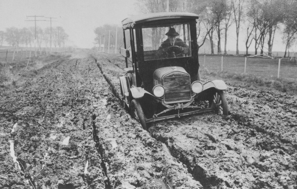
A car stuck in the mud near Tama, Iowa in 1919
Photo courtesy of the Iowa Department of Transportation Historic Archives
In 1912, there were almost no good roads to speak of in the United States. The relatively few miles of improved road were only around towns and cities. A road was “improved” if it was graded; one was lucky to have gravel or brick. Asphalt and concrete were yet to come. Most of the 2½ million miles of roads were just dirt: bumpy and dusty in dry weather, impassable in wet weather. Worse yet, the roads didn’t really lead anywhere. They spread out aimlessly from the center of the settlement. To get from one settlement to another, it was much easier to take the train.
Carl Fisher
Photo courtesy of the Lincoln Highway Digital Image Collection at the University of Michigan
Carl Fisher recognized this situation, and an idea started to take hold. Fisher was a man of ideas. As soon as he thought of a project and got it started, he would grow restless and start on another one. His Indianapolis Motor Speedway was a success, especially after he paved it with brick and started the Indianapolis 500, and he would later turn a swamp into one of the greatest beach resorts: Miami Beach, Florida. However, in 1912, he dreamed of another grand idea: a highway spanning the continent, from coast to coast.
He called his idea the Coast-to-Coast Rock Highway. The gravelled road would cost about ten million dollars, low even for 1912. Communities along the route would provide the equipment and in return would receive free materials and a place along America’s first transcontinental highway. The highway would be finished in time for the 1915 Panama-Pacific Exposition and would run from the exposition’s host, San Francisco, to New York City.
To fund this scheme, he asked for cash donations from auto manufacturers and accessory companies of 1 percent of their revenues. The public could become members of the highway organization for five dollars.
Fisher knew that success of the ten-million dollar fund would depend on the support of Henry Ford. Unfortunately, even after many persuasive attempts by friends and close associates, Ford would not support the project. The public would never learn to fund good roads if private industry did it for them, he reasoned. This put the fund in jeopardy; there would not be enough time or money to finish the highway by the exposition in 1915. However, now that the country had become so enthusiastic about the highway, Fisher would not give up. Two men from the automobile industry who pledged money to Fisher’s idea would later play major roles in the highway’s development: Frank Seiberling, president of Goodyear, and Henry Joy, president of the Packard Motor Car Company.

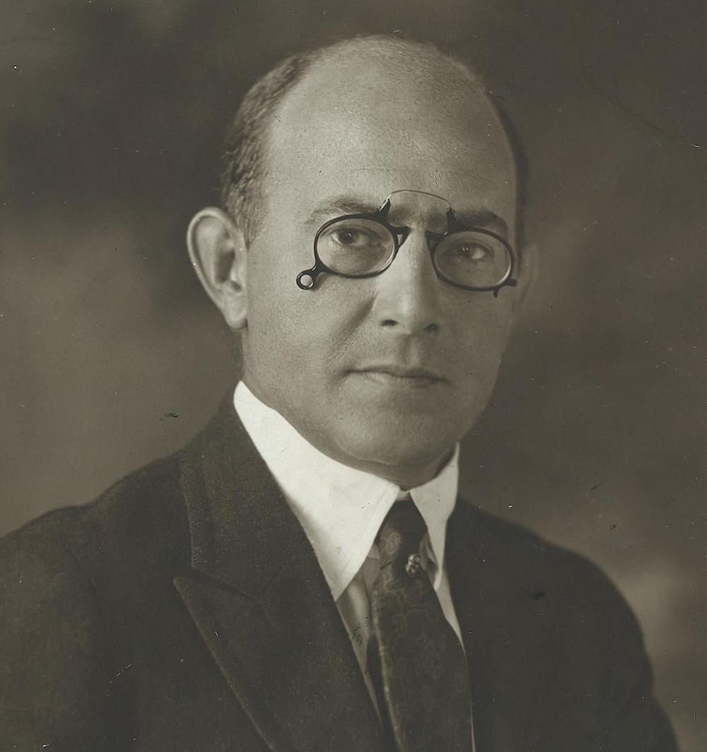
Henry Joy
Photo courtesy of the Lincoln Highway Digital Image Collection at the University of Michigan
Henry Joy came up with the idea of naming the highway after Abraham Lincoln. He wrote Fisher urging him to write a letter of protest to Congress, which was considering spending $1.7 million on a marble memorial to Lincoln. Joy thought a good road across the country would be a better tribute to the president. The name “Lincoln” captured Fisher’s fancy; he realized it would give great patriotic appeal to the highway. Fisher asked Joy if he wanted to be involved directly with the highway project. At first, Joy was hesitant, but soon he wholeheartedly supported the project and became the primary spokesman for the highway.
Picking a Route
On July 1, 1913, the association decided to call the coast-to-coast highway the Lincoln Highway, and it was officially incorporated as the Lincoln Highway Association. Henry Joy was elected as president. Carl Fisher, who was elected vice-president, was not present. He had departed with the Indiana Automobile Manufacturers association on a trip to the West Coast. The “Hoosier Tour” was intended, in part, to explore possible routes for the Lincoln Highway. The tour route included Colorado and Kansas. While Fisher tried to distinguish the Hoosier Tour route from the eventual route of the Lincoln Highway, he all but promised the governors of Colorado and Kansas that the highway would pass through their states. They were set up for a big disappointment.
Fisher kept the route of the Lincoln Highway a secret as long as he could because 1) he wanted the nation as a whole to support the highway, not just the states through which it would pass, and 2) he didn’t know what the route was. No decision had been made. After Hoosier Tour, the association decided they needed to pick a route.
As far as Joy was concerned, directness was the most important factor. By bypassing many scenic attractions and larger cities along the way, narrow winding roadways and congestion could be avoided.
After weeks of deliberation, Henry Joy presented the route before the annual Conference of Governors in Colorado Springs. The highway started in Times Square in New York City. It passed through New Jersey, Pennsylvania, Ohio, Indiana, Illinois, Iowa, Nebraska, Wyoming, Utah, Nevada, and California, ending in Lincoln Park in San Francisco. The route did not deviate from a straight path in order to go through larger cities or national parks. It did not touch Kansas or Colorado. Joy’s influence was clear.

The governors of Colorado and Kansas were embarassed for having heartily supported the Hoosier Tour, only to find themselves bypassed. After forceful appeals from Colorado’s governor, the association agreed to a dogleg from Big Springs, Nebraska southwest to Denver, and then back to the main highway at Cheyenne. After the route was announced to the public one month later, the decision to include the dogleg would come back to haunt them.
Almost immediately, the Lincoln Highway Association received letters trying to change the route; it politely declined every request. The association learned its lesson. Two years later, it dropped the Denver dogleg from its maps and guides and warned drivers not to be mislead by signs in Big Springs pointing them to Denver.
From Dirt Path to Concrete
The Lincoln Highway Association set up a system of “consuls” along the highway who would act as local ambassadors. They would represent the highway in local affairs, assist visitors, and let the headquarters know of matters concerning the highway.
However, in 1914, there wasn’t much of a highway to be concerned about. No improvements had been made to the Lincoln Highway, and with Ford’s refusal to chip in and growing disinterest of people left off the route, the ten-million-dollar fund that Fisher had set up had stalled at the halfway point. Joy decided to abandon the fund and instead redirect the association to a new goal: educating the country for the need for good roads made of concrete, with an improved Lincoln Highway as an example. It would oversee the construction of concrete “seedling miles” way out in the countryside to emphasize the superiority of concrete over unimproved dirt. As people would learn about concrete, they would press the government to construct good roads throughout their state.

Over the next several years, some kinks in the highway were straightened out. A section in Ohio that ran through Marion, Kenton, and Lima was soon bypassed by a straighter route to the north. Somewhat insulted at being left off the Lincoln Highway, the citizens of those towns claimed the southern route as the Harding Highway, after hometown hero President Warren Harding. A route through Fort Wayne, South Bend, and Valparaiso in Indiana was bypassed by a straighter route to the south.

In the deserts of Utah, west of Salt Lake City, a new route called the Goodyear Cutoff was surveyed and prepared for construction. However, Utah did not want this part of the Lincoln Highway finished. By improving the Arrowhead Trail to Los Angeles, travelers, and their money, were kept in the state for hundreds of more miles. The Utah state government promoted a route directly west of Salt Lake City to Wendover, Nevada as the route to San Francisco. This route crossed miles of salt desert, which was often submerged under water. To improve the Wendover road would take much more money than improving the Lincoln Highway.
In 1921, the federal government passed the Federal Highway Act of 1921. Like a similar act passed in 1916, it provided $75 million of matching funds to the states for highway construction. However, unlike the 1916 act, the 1921 act required the states to identify 7 percent of its total mileage was “primary”; only these roads would be eligible for federal funds.
In most states in which it ran, the Lincoln Highway was the obvious choice as a federal road, but there were a few exceptions. The Harding Highway in Ohio lobbied heavily and was improved at the expense of the Lincoln. However, the biggest challenge was in Utah.

The Wendover route was still favored by Utah, and now it was part of another named highway: the Victory Highway. Like the Lincoln, it claimed New York and San Francisco as its endpoints, but it claimed the Wendover road and the route along the Humboldt River in Nevada, which pitted it directly against the Lincoln. It was virtually unknown in the east but was favored in Utah, Nevada, and northern California. Like their fellow Utah citizens, northern Californians favored the Victory for economic reasons: travelers along the Victory would almost certainly go to San Francisco. If travelers took the Lincoln through western Utah, they could easily go drive southwest towards Los Angeles via the Midland Trail, as it was about as far away as San Francisco.
Despite numerous reports and heavy lobbying by the Lincoln Highway Association, the federal government selected the Wendover route as the federal road. Consequently, the Victory was also declared the federal road in Nevada. The Goodyear Cutoff, which was never finished by Utah’s government, would remain unimproved.
The End of Named Highways
In ten years, between 1915 and 1925, the United States went from having one named highway to having an unorganized and confusing system of named highways. They were primarily marked by painted colored bands on telephone poles. Sometimes, where several named highways shared a route, almost an entire pole would be striped in various colors. It was time for an organized national system of highways to be formed. A system of numbered highways.
The Lincoln Highway Association was all for a numbered highway system, as long as one number corresponded to the Lincoln Highway and the names stayed with the roads. It didn’t want to see its highway chopped up into little numbered bits. In March 1925, the American Association of State Highway Officials (AASHO) started planning a federal highway system. All named roads were ignored in their planning. That November, the secretary of agriculture approved AASHO’s plan, which set up the now-familiar U.S. highway system.

Major east-west routes would be numbered in multiples of ten, from U.S. 10 across the north to U.S. 90 across the south. Major north-south routes would end in 1 or 5, from U.S. 1 between Maine and Florida to U.S. 101 between Washington and California. The Lincoln Highway was broken up into U.S. 1, U.S. 30 (including U.S. 30N and U.S. 30S), U.S. 530, U.S. 40, and U.S. 50. Nearly two-thirds of the Lincoln’s length was designated U.S. 30, which began in Atlantic City, New Jersey and ended in Astoria, Oregon. The AASHO also adopted a standard set of road signs and markers, and to avoid confusion, all markers of all named roads would have to be taken down.


Interest in the Lincoln Highway dropped considerably. The association ceased activity at the end of 1927. Its last major activity was to mark the highway not as a route from one destination to another, but as a memorial to Abraham Lincoln. On September 1, 1928, thousands of Boy Scouts fanned out along the highway. At an average of about one per mile, they installed small concrete markers with a small bust of Lincoln and the inscription, “This highway dedicated to Abraham Lincoln.”
While the other named highways were quickly forgotten, the Lincoln Highway was not. A whole generation of Americans, exposed to the well-organized publicity of the Lincoln Highway Association, kept the Lincoln Highway alive long after its official significance was gone. It was the backdrop for an NBC radio show on Saturday mornings. Airing for two seasons in the 1940s, it had an audience of 8 million listeners.
By the late 1940s, the Lincoln Highway started to fade away. A new generation of Americans were born, one which had grown up with paved roads and a numbered highway system. Most Baby Boomers, and even more of their children, have never heard of the Lincoln Highway.

However, not everyone has forgotten. The Lincoln Highway Association was reactivated in 1992, dedicated to preserving the highway. With the help of the association, the Lincoln Highway will always live on.